


 English (United Kingdom)
  Italiano (Italia)
  Deutsch (Deutschland)
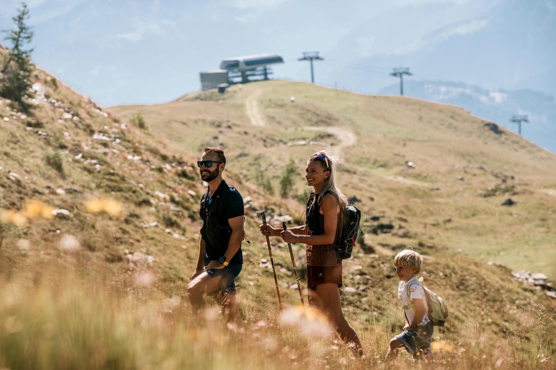
hiking experience Osttirol
our tour tips for the Hochstein & Zettersfeld
“Steinermandl” via “Rottmannalm” |

starting point: EUB top station
end point: “Rottmannalm”
highest point: 2,220 m
total waling time: 2 hrs
distance: 5.5 km
altitude uphill: 400 m
difficulty: easy
walking time uphill: 2.5 hrs
Where the “Helenental” mountain road reaches the peak at Zettersfeld (20 min. northwest of the cable car top station), a path leads across mountain meadows to the “Rottmannalm”, 5 minutes. From there, a much-used path leads up on the western edge of the Zettersfeld and on to the lake “Lackenboden” at 2080 m. In winter, the lake feeds the snow cannons. A last upswing allows you to visit the “Steinermandl” to the northeast and the “Schoberköpfl” to the north.
Lakes “Neualplseen” – circular trail |
starting point: “Steinermandl” top station
end point: lakes “Neualplseen”
highest point: 2,470 m
total waling time: 2.5 hrs
distance: 6.8 km
altitude uphill: 300 m
difficulty: easy
walking time uphill: 1.5 hrs
From the top station of the “Steinermandl” chairlift at 2,213 m, follow the well-marked trail north of and past the “Goisele”.
After a little descent of about 200 m, walk across the flat pastures, past the “Stammtisch” to the lakes “Neualplseen”.
After a walk around the lakes and a little rest, you can take the same route back or you walk past the “Neualplschneid” that runs south of the “Goisele”.
“Schleinitz” – hiking trail |
starting point: “Steinermandl” top station
end point: “Schleinitz”
highest point: 2,890 m
total waling time: 5 hrs
distance: 9 km
altitude uphill: 750 m
difficulty: difficult
walking time uphill: 2.5 hrs
From the top station of the “Steinermandl” chairlift at 2,213 m, follow the well-marked trail AV No. 913 northwards. Southwest of the “Goiselemandl” via the Neualplschneid” to the south shore of the lakes “Neualplseen”. At the signpost at the south shore, walk along a moraine until you reach the western part of the lake area. After a few rocky sections, the trail continues up the marked path across rough terrain to the southern summit ridge before reaching the summit cross. After that it is only a few more meters of altitude until you reach the actual summit at 2,905 m.
“Östliche Sattelköpfe” |
starting point: EUB top station
end point: EUB top station
highest point: 2,696 m
total waling time: 4.5 hrs
distance: 11 km
altitude uphill: 850 m
difficulty: easy
walking time uphill: 2.5 hrs
Go westwards over the gravel road to the “Rottmannalm” (1,900 m). There the marked trail (9a) begins. It leads north across alpine pastures, and then westwards past the reservoir (2,100 m) until below the peak of the “Goiselemandl” (2,370 m). From there, continue northwestwards, and go along the narrow path “Neualplschneid” to the lakes “Neualplseen” (2460). Now northwards, past the lakes “Neualplseen” up to the summit ridge. The last ascent to the peak is rather flat, but it includes overcoming a part that is secured by a wire rope. The summit cross of the “Östlicher Sattelkopf” is at 2,651 m of altitude.
TIP: You can also take the chairlift to the “Steinermandl” and thereby save about one hour of walking time.
Family Park Zettersfeld |
starting point: “Steinermandl” valley station
end point: “Steinermandl” valley station
highest point: 1,850 m
total waling time: 1.5 hrs (without playing time)
distance: 3.4 km
altitude uphill: 28 m
difficulty: easy
walking time uphill: 45 mins
Along the path from the Zettersfeld top station to the hut “Naturfreundehütte” and back to the “Alm” there are 15 adventure playgrounds. Every playground invites families to play, romp around or simply relax. Inquisitive visitors can also gather information about native animals. With a little imagination, the adventure story of the family park mascot “Steiner Mandl” brings the playground to life and promises an exciting day at the Zettersfeld.
“Moosalm” – “Sternalm” |

starting point: “Moosalm”
end point: “Sternalm”
highest point: 1,500 m
total waling time: 1 to 1.5 hrs
altitude uphill: 500 m
difficulty: easy
walking time uphill: 1 to 1.5 hrs
From “Moosalm” you can either take the 4 km long forest road up to the “Sternalm” or, from the reservoir “Taxer Moos” onwards, you can also take the so-called “Russenweg” path.
“Sternalm – „Böses Weibele” |
starting point: “Sternalm”
end point: “Böses Weibele”
highest point: 2,521 m
total waling time: 6 to 7 hrs
altitude uphill: 1,520 m
difficulty: average
walking time uphill: 3 to 3.5 hrs
From the “Sternalm” first go to the hut “Hochstein” (about 1.5 hrs of walking time). From there, walk along the flat mountain pastures. The summit of the “Böses Weibele” at 2,521 m always in view, follow the trail no. 9 along the “Hochstein” ridge and to the summit.
“Reiterkirchl” |
starting point: “Moosalm”
end point: “Reiteralm Kirchl” (little church)
highest point: 1,193 m
total waling time: 1 to 1.5 hrs
distance: 1.3 km
altitude uphill: 221 m
difficulty: easy
walking time uphill: 45 mins
From the “Moosalm” a forest road leads up to the reservoir “Taxer Moos”. From there, follow the signs “Reiteralm” and “Reiter Kirchl”. On your way back, you can follow the marked trail up to the “Moosalm” or down to the “Gribelehof”.
“Märchensteig” (Fairytale Trial) to the “Hochsteinhütte“ |
starting point: “Sternalm”
end point: hut “Hochsteinhütte”
highest point: 2,020 m
total waling time: 1.5 to 2 hrs
distance: 2.5 km
altitude uphill: 520 m
difficulty: average
From the top station of the chairlift H2, downwards along the pasture (a slope in winter) in the direction of the laker “Hubertus”. At the reservoir, the trail ”Märchensteig” begins. The markings on trees, yellow triangles with a red margin, help you to find your way. Half the way up, at about 1,780 m above sea level, you will find a nice shelter, just before you disappear into the forest. You will reach open terrain again shortly before the hut “Hochsteinhütte”.
TIP: From the hut “Hochsteinhütte”, a gravel path leads up to the summit cross (walking time is about 15 mins).


